By Grainger Wilson *
There’s a neat new Highway’s “Stop of Interest” sign in Woodenhead Park. On the river bank next to the bridge.
“River of History” celebrates the Columbia.
Check it out. What it does not share is the remarkable singularity of that exact spot on the river.
We all know Revelstoke straddles our 1st Canadian Trans-Continental Railroad, as well as our 1st Transcontinental Highway, the Trans Canada. Many hundreds of communities can make the same claim. But only one of them – a single solitary one – is also on the North American Continent’s very 1st “North West Passage” to the Pacific.
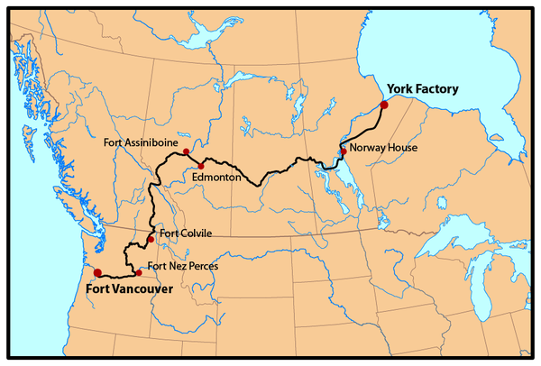
“Big Eddy” back then was a named navigational hazard on the Hudson Bay Company’s famous “York Factory Express”. From David Thompson’s establishment of Boat Encampment at the Bend of the Columbia in 1811, until a half dozen years after the settlement of the Oregon Boundary Dispute in 1845, Big Eddy is smack dab on the main transcontinental Fur-Brigade trunk route established by the HBC. Anyone going to or from the Pacific slips past Big Eddy. No other community, or spot on the map, has alway been on the transcontinental ‘main-drag’. Only Big Eddy.
Standing at the Stop of Interest sign in 1847, skilfully skirting the Big Eddy you see Brigades of Metis designed, built, and powered “batteaux” ferrying HBC cash, trade goods, and human resources to and from York Factory on Hudson Bay, and Columbia Department Forts all the way down to the mouth of the river. The Crown of England claimed the entirety of the Columbia drainage basin as it’s own and granted a fur-trade monopoly to the HBC. He then left HBC to administer the entirety of this vast territory, which includes all of present day Idaho as well as much of Washington and Oregon. HBC did so via the York Factory Express – with a regular stop in Big Eddy. Sometimes, in the famous Metis built Columbia Boats, travelling celebrity guests of the HBC float by. A Botanist in one party, a Geologist in another, and today the famous painter, Paul Kane, in still another.

Kane gives us our first depiction Boat Encampment, as well first images of our two most formidable local navigational hazards, “2nd Little Dalles Canyon” (site of Revelstoke Dam) and the much feared, and gruesomely storied, “Dalles Des Mort”, 64 km above us, at the foot of ‘the largest known slope instability in the world’: The Downie Slide. On his return trip with the Brigades back across the Continental Divide to York Factory, Kane camped below the Dalles Des Mort and journaled the gruesome horrors that befell a Brigade at that spot in the spring of 1817, as related to him by his guide – a son of one who was eaten.
That’s another story, but perhaps not appropriate Stop of Interest Sign material.
* Grainger studied History before pursing a career in the Ministry of Highways. Grainger enjoys sharing unique tidbits of Revelstoke and areas lesser known past.

Kanes ominous 1840’s “Dalles Des Mort” That’s now covered Frenchman’s Cap peak in the background, and the Downie Slide slowly toppling into the river on the right

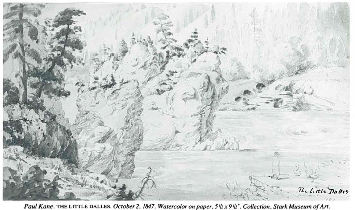
2nd little Dalles Canyon, looking downstream. It is the site of Revelstoke Dam. Descriptions of this spot at full spring freshet are legendary.
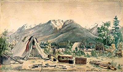
Kane’s boat Encampment
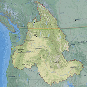
King George III hadn’t the foggiest what he was claiming in “the entire drainage basin of the Columbia
Facebook Comments